The Visayan Sea forces a stark choice upon the diver: sheer drop-offs, expansive muck plains, or open-ocean pelagic channels. Cebu fractures into three distinct operational theaters that dictate this underwater reality. Malapascua commands the north, pulling divers into deep-water shark encounters. Down south, the corridor stretching from Moalboal to Oslob collapses into vertical coral walls and massive biological aggregations. Mactan Island anchors the center—a staging ground granting immediate deep-water access for technical descents alongside sheltered macro sanctuaries. Surviving and succeeding in these zones requires a firm grasp of their specific depth profiles, logistical choke points, and tidal mechanics.
Region 1: The North – Malapascua Island
The isolation of Malapascua sets its rhythm. Earning access demands a 140-kilometer overland transit from Cebu City to Maya Pier, bleeding into a 45-minute outrigger crossing. Private car transfers extract between 3,000 and 4,500 PHP and consume roughly four hours, though the choked northern coastal highway often dictates the final tally. Stepping ashore strips away modern convenience. Combustion engines are absent. The local economy survives entirely on physical currency, with the sole ATMs routinely emptying and merchants levying a standard five percent surcharge on credit transactions. Visitors surrender a daily Marine Tax of 300 PHP directly to the municipal authorities.
That rustic topside reality belies a subterranean precision. Institutional operations like the Malapascua Exotic Island Dive Resort function with maritime rigor, launching armadas of traditional bangkas toward the deep-water shoals long before dawn breaks the horizon.
Monad Shoal and Kimud Shoal represent the only verifiable coordinates globally where divers can witness pelagic thresher sharks (Alopias pelagicus) executing their daily hygiene cycles at cleaning stations year-round.
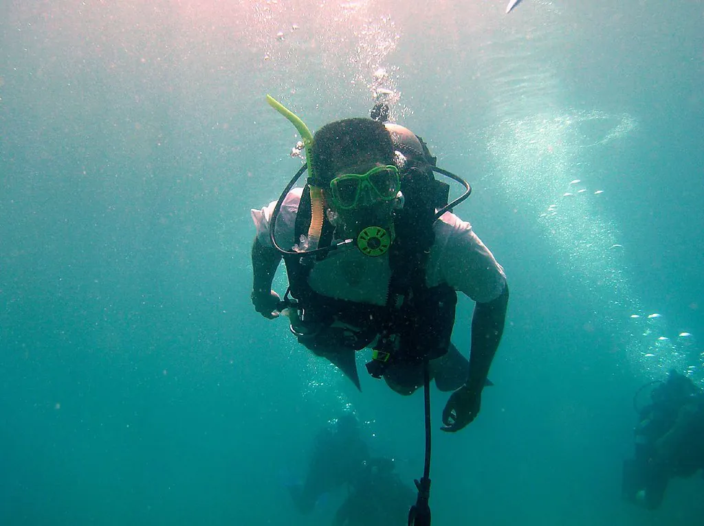
Marine Biologist Field Notes
Those pre-dawn descents plunge divers through severe thermoclines and wildly fluctuating water temperatures. Calibrate your expedition to the clearest visibility windows by studying our Best Time & Weather for Scuba Diving guide.
Kimud Shoal
The epicenter of the thresher encounter has shifted. Kimud Shoal eclipses Monad as the primary observation deck, requiring an hour-long boat transit to a sunken island defined by a massive plateau that shears off into the abyss. Reaching this remote coordinate incurs a 150 PHP Special Diver Fee and a 500 PHP fuel surcharge to offset the distance.
- Primary Focus: Pelagic thresher sharks (Alopias pelagicus).
- Topography & Depth: Sunken plateau at 12-15 meters dropping well beyond 200 meters.
- Current Level: Moderate to strong, heavily dictated by lunar cycles.
Precision buoyancy controls the success of the encounter. Divers suspend motionless along the 12 to 15-meter shelf; erratic movements shatter the sharks’ fragile comfort zones. Our Encountering the Thresher Sharks of Malapascua dispatch details the exact protocols and descent mechanics required for this theater.
Monad Shoal
The threshers’ migration to Kimud leaves Monad Shoal far from abandoned. Its 20-meter drop-off edge functions as a stark arena for tiger sharks, reef mantas (Mobula alfredi), and occasional devil ray squadrons circling the isolated reef blocks.
- Primary Focus: Tiger sharks, manta rays, and pelagic transients.
- Topography & Depth: Flat-topped seamount peaking at 20 meters.
- Current Level: Moderate to strong.
Open-ocean exposure and immediate depth render this seamount hostile to novices; an Advanced Open Water certification forms the absolute baseline for entry. Divers lacking the required credentials can secure them through the certification pathways mapped on our Guided Tours & Lessons page.
Region 2: The South – Moalboal
Ninety kilometers southwest of the capital, the geography shifts. Moalboal has shed its origins as a subsistence fishing outpost to command the Visayan macro and wall diving scene. Action centers entirely on Panagsama Beach—a dense, pedestrian-only gauntlet of resorts, equipment technicians, and immediate shore entries. Veteran operations like the Savedra Dive Center, a PADI 5-Star Career Development Center, orchestrate the daily launch of dozens of vessels to the adjacent reef systems.
The underwater architecture defines the biological density. A fringing reef extends a mere 20 to 30 meters from the shoreline before collapsing vertically into a void exceeding 40 meters. This geological fracture forces a massive nutrient upwelling, sustaining staggering volumes of marine life. When residual nitrogen forces divers out of the water, they often move inland to trace the hydro-topography of Kawasan Falls. Precise logistical routing to those freshwater canyons exists within our Other Things to Do in Cebu guide.
| Dive Site | Region | Typical Depth | Current Level | Marine Life Focus |
|---|---|---|---|---|
| Kimud Shoal | North (Malapascua) | 30m+ | Moderate/Strong | Thresher Sharks |
| Monad Shoal | North (Malapascua) | 20m – 30m | Moderate/Strong | Tiger Sharks, Manta Rays |
| Sardine Run | South (Moalboal) | 5m – 30m+ | Mild/Moderate | Millions of Sardines, Sea Turtles |
| Pescador Island | South (Moalboal) | 10m – 40m+ | Moderate | Frogfish, Coral Walls, Sea Snakes |
The Sardine Run (Panagsama Beach)
A biological anomaly churns a mere 20 meters off the Panagsama shoreline. An estimated seven million sardines (Sardinella lemuru) fuse into a singular, shifting baitball dense enough to obliterate ambient sunlight. This metallic mass runs parallel to the drop-off, expanding and contracting between 5 and 30 meters under the constant pressure of pelagic predators.
- Primary Focus: Sardine aggregations, green sea turtles (Chelonia mydas), and predatory giant trevally.
- Topography & Depth: Fringing reef wall from 5 meters dropping past 30 meters.
- Current Level: Mild to moderate.
The crushing density of the school casts a striking, chaotic backdrop for wide-angle frames; simultaneously, the shallow reef plateau conceals delicate nudibranch species. Calibrating strobe outputs for such extreme contrast requires technical finesse—our Mastering Macro: Finding Cebu’s Smallest Wonders guide details the necessary exposure adjustments.
Pescador Island Marine Sanctuary
A brief ten-minute outrigger run breaks the coastal monotony, terminating at a rocky, uninhabited limestone pillar jutting from the Tañon Strait. Pescador Island reveals its true scale below the waterline, where dramatic vertical walls plunge without interruption into a 300-meter-deep channel.
- Primary Focus: Gorgonian sea fans, giant frogfish (Antennarius commerson), banded sea kraits, and passing pelagics.
- Topography & Depth: Steep vertical walls starting at 5 meters and descending past 40 meters.
- Current Level: Moderate to strong, with occasional downdrafts on the northern tip.
The western facade features The Cathedral—a cavernous rupture dropping vertically to 35 meters. The severity of these depth profiles transforms the island into a premier staging ground for decompression training. Our Technical Diving: Exploring Cebu’s Deep Walls manual maps the advanced gas planning required to penetrate these zones safely.
Region 3: The Deep South – Oslob
Pushing further down the southern coastal highway introduces a radically different theater. Oslob abandons the remote grit of Malapascua and the diver-centric rhythm of Moalboal, operating instead within a highly commercialized, heavily regulated interaction framework. Local government units confine all water entries to the morning hours; this strict scheduling attempts to mitigate environmental strain while managing the crushing influx of overland tourism.
Whale Shark Watching Center (Tan-awan)
The coastal waters off the barangay of Tan-awan secure daily, guaranteed encounters with juvenile and sub-adult whale sharks (Rhincodon typus). The infrastructure heavily favors snorkelers and freedivers, yet scuba access remains an authorized and frequent component of broader southern itineraries. Depth profiles here are exceptionally shallow—hovering between 5 and 10 meters over barren sandy substrates—with negligible current. Scuba ascents trigger a strict 60-minute submerged limit; breaching the mandatory five-meter proximity rule invites immediate municipal fines.
Region 4: Central Cebu – Mactan Island
Mactan Island anchors the logistical machinery of Cebu diving. Because it houses the Mactan-Cebu International Airport, arriving divers can transition from tarmac to salt water in under thirty minutes. The heavily developed coastline trades isolation for specialized infrastructure, supporting facilities capable of transitioning an absolute beginner through confined water drills or supplying trimix to a technical diver executing a 100-meter descent.
Shangri-La Marine Sanctuary
The house reef at the Shangri-La Mactan Resort stands as a rare success in deliberate marine regeneration, harboring dense macro populations, schooling batfish, and resident jacks. Divers slip into the water via the shoreline or a fleeting boat transfer. A gradual slope descends from 5 to 25 meters through sheltered, zero-current water. Divers seeking immediate submersion without the punishment of overland transit can book a guided Mactan beach entry scuba experience to observe localized sardine schools just off the beach.
The Eastern Walls
The eastern perimeter of Mactan shatters the illusion of a gentle slope. Topography here collapses into extreme drop-offs; coordinates like Marigondon Cave and the deeper walls of Olango Island demand vertical descents plummeting 70 to 80 meters. Variable, unpredictable currents rip through absolute darkness at these depths—surviving the eastern walls requires redundant buoyancy devices, rigorous gas management, and advanced technical configurations.
Navigating Local Fees & Regulations
Submerging in Cebu binds the diver to a patchwork of municipal ordinances designed to fund reef preservation. Mandatory Environmental User’s Fees (EUF) apply across all theaters. Malapascua extracts a 300 PHP daily Marine Tax, complicated by fuel surcharges for distant shoals. Down in Oslob, wardens enforce rigid equipment bans, stripping divers of underwater flash photography and chemical sunscreens. Violating these parameters triggers the immediate termination of the dive alongside severe fines or institutional blacklisting. Real-time regulatory shifts frequently disrupt itineraries; studying the official advisories published by the Department of Tourism is essential prior to departure.
Plan Your Cebu Dive Adventure
The geographic fractures of Cebu accommodate wildly distinct ambitions—from executing a dawn descent with thresher sharks in the Visayan Sea to mapping the deep vertical fissures of Pescador Island. Realizing those ambitions depends entirely on logistical pacing. Transits between the Mactan airport, the northern pier of Maya, and the southern bottleneck of Moalboal routinely consume entire days. Pushing the schedule tightens the margin of safety; mandatory no-fly times dictate the final extraction.
Do not attempt to compress Malapascua and Moalboal into a single 48-hour window. The overland fatigue will compromise your safety in the water.
Primary life support equipment and exposure suits require precise calibration to the thermal and tidal realities of these distinct zones. Our Equipment & Safety Guide maps out the necessary hardware alongside regional hyperbaric chamber locations. Finalizing an itinerary requires vetted logistics—the Official PADI Cebu Travel Guide supplies a directory of certified operators. Secure your vessels, verify your credentials, and prepare to drop into a brutally beautiful, uncompromising marine environment.